Delve into Burraneer
The district Burraneer of in New South Wales is a subburb in Australia about 142 mi north-east of Canberra, the country's capital town.
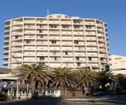
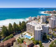
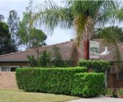
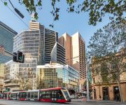
If you need a hotel, we compiled a list of available hotels close to the map centre further down the page.
While being here, you might want to pay a visit to some of the following locations: Sydney, Parramatta, Katoomba, Canberra and . To further explore this place, just scroll down and browse the available info.
Local weather forecast
Todays Local Weather Conditions & Forecast: 23°C / 74 °F
| Morning Temperature | 18°C / 64 °F |
| Evening Temperature | 22°C / 72 °F |
| Night Temperature | 20°C / 69 °F |
| Chance of rainfall | 0% |
| Air Humidity | 61% |
| Air Pressure | 1019 hPa |
| Wind Speed | Fresh Breeze with 15 km/h (10 mph) from South-West |
| Cloud Conditions | Clear sky, covering 1% of sky |
| General Conditions | Sky is clear |
Sunday, 24th of November 2024
23°C (73 °F)
21°C (69 °F)
Overcast clouds, moderate breeze.
Monday, 25th of November 2024
23°C (73 °F)
21°C (70 °F)
Light rain, fresh breeze, broken clouds.
Tuesday, 26th of November 2024
24°C (75 °F)
23°C (73 °F)
Light rain, moderate breeze, broken clouds.
Hotels and Places to Stay
EVENTHOUSE CRONULLA
QUEST CRONULLA BEACH SERVICED APTS
Cronulla Motor Inn
Metro Hotel Miranda
Abcot Inn
Sutherland Motel
Meriton Suites Campbell Street
Videos from this area
These are videos related to the place based on their proximity to this place.
Meet the Mermaids - Behind the Scenes for the Oporto 2014 Cronulla Sharks Mermaids Photoshoot
Meet the Cronulla Sharks Mermaids http://www.sharks.com.au/team/cheerleaders.html Shark's budding junior filmmaker (and Sharksstore http://www.sharksstore.com.au sales assistant) Renee takes...
M.V. Curranulla - Cronulla Ferry
M.V. Curranulla claims to be the oldest operating ferry in Australia working to a regular timetable. The ferry runs between Cronulla, Simpsons Bay, and Bundeena. Visit: http://theworklife.com.
Cronulla Sharks - On the Seventh Day of Christmas #upupcronulla
Wishing all Cronulla Sharks members, fans, sponsors and staff a very Merry Christmas and a Happy New Year. http://www.sharksstore.com.au SharksTV - Home of the Cronulla Sharks Rugby League...
North Cronulla Beach July 2011
North Cronulla Beach looking towards Wanda, Storm surge and beach erosion. Friday 22nd July 2011 - Sydney's wettest July since 1950 Sydney has picked up over 200mm of rain since Tuesday...
Cronulla Sharks It's Feeding Time
See the Cronulla Sharks take on the NRL. How did your team fare against a real, live version of our mascot? Check out all the action here.
Fiesta @ the Beach, Dunningham Park, Cronulla
Fiesta @ the Beach is a vibrant and colourful, multicultural annual event in the Sutherland Shire. Fiesta is a family friendly day filled with live entertainment, kids activities, and a host...
Dentist Cronulla, Call (02) 8515 0235
http://www.dentistcronulla.net.au - Dentist Cronulla. Get The Best Dental Care In The Shire For Everything From Dental Diseases to Cosmetic Dentistry- Call (02) 8515 0235 Address: 64 Cronulla...
Videos provided by Youtube are under the copyright of their owners.
Attractions and noteworthy things
Distances are based on the centre of the city/town and sightseeing location. This list contains brief abstracts about monuments, holiday activities, national parcs, museums, organisations and more from the area as well as interesting facts about the region itself. Where available, you'll find the corresponding homepage. Otherwise the related wikipedia article.
Bundeena, New South Wales
Bundeena is a village on the outskirts of southern Sydney, in the state of New South Wales, Australia. Bundeena is located 29 km south of the Sydney central business district and is part of the local government area of the Sutherland Shire. Bundeena is adjacent to the village of Maianbar and lies on the southern side of Port Hacking, opposite the suburbs of Cronulla and Burraneer. The village is surrounded by the Royal National Park.
Caringbah, New South Wales
Caringbah is a suburb, in southern Sydney, in the state of New South Wales, Australia. Caringbah is 24 kilometres south of the Sydney central business district in the local government area of Sutherland Shire. Caringbah once stretched from Woolooware Bay on the Georges River to Yowie Bay and Burraneer Bay on the Port Hacking estuary. A number of Caringbah localities have been declared as separate suburbs but still share the postcode 2229.
Cronulla, New South Wales
Cronulla is a beachside suburb, in southern Sydney, in the state of New South Wales, Australia. Cronulla is located 26 kilometres south of the Sydney central business district, in the local government area of Sutherland Shire. Cronulla is located on a peninsula framed by Botany Bay to the north, Bate Bay to the east, Port Hacking to the south, and Gunnamatta Bay to the west. The neighbouring suburb of Woolooware lies to the west of Cronulla, and Burraneer lies to the southwest.
Cronulla railway station
Cronulla railway station is a railway station on the Cityrail network, a short distance from Cronulla Beach of Sydney, Australia, on the Pacific Ocean. It is the eastern terminus of a dual line railway from Sutherland, New South Wales. The station is unusual in that the two platforms are situated end to end, rather than side by side. The station has Easy Access for wheelchairs because the platforms are at street level.
Shark Island (Cronulla Beach)
Shark Island is a dangerous reef break about 100 metres off Cronulla, New South Wales, Australia. It comprises a rock ledge that is fully exposed at low tide. The island is a well-known bodyboarding and surfing location. The wave can stand up fast and violently ("jack up" in surfing jargon), making it difficult and dangerous. The island is regarded by bodyboarders as producing one of the "heaviest" waves in the world.
Port Hacking, New South Wales
Port Hacking is a small suburb in southern Sydney, in the state of New South Wales, Australia 26.7 kilometres south of the Sydney central business district in the local government area of the Sutherland Shire. The suburb sits on the north shore of the Port Hacking estuary.
Maianbar, New South Wales
Maianbar is a village on the outskirts of southern Sydney, in the state of New South Wales, Australia 29 kilometres south of the Sydney central business district. It is part of the Sutherland Shire. Maianbar is adjacent to the village of Bundeena, less than kilometre away and linked by a bush track and footbridge. It lies on the southern side of Port Hacking, opposite the suburbs of Burraneer, Dolans Bay, Port Hacking, Lilli Pilli and Cronulla. Maianbar is surrounded by the Royal National Park.
Lilli Pilli, New South Wales
Lilli Pilli is a small suburb in southern Sydney, in the state of New South Wales, Australia. Lilli Pilli is located 26 kilometres south of the Sydney central business district, in the local government area of the Sutherland Shire. There is also another Lilli Pilli in New South Wales (postcode 2536), located 12 kilometres south of Batemans Bay.
Burraneer, New South Wales
Burraneer is a small suburb in southern Sydney, in the state of New South Wales, Australia. Burraneer is 26 kilometres south of the Sydney central business district, in the local government area of the Sutherland Shire. Burraneer sits on the peninsula of Burraneer Point, on the north shore of the Port Hacking estuary. Burraneer Bay forms the western border and Gunnamatta Bay the eastern border. Woolooware is the only adjacent suburb. Cronulla is located across Gunnamatta Bay.
Dolans Bay, New South Wales
Dolans Bay is a suburb in southern Sydney, in the state of New South Wales, Australia 26 kilometres south of the Sydney central business district, in the local government area of the Sutherland Shire. Dolans Bay is on the north shore of the Port Hacking estuary. The suburb is named after the small bay on the edge of Burraneer Bay. Houses overlook the bay and some line the water's edge together with boatsheds. Boats are moored in the bay, which provides protection from the southerly wind.
Caringbah High School
Caringbah High School is located on Willarong Road North in the suburb of Caringbah, in the Sutherland Shire, Sydney. It is one of ten academically selective, public and co-educational high schools in New South Wales. Caringbah High School students achieve consistently high marks in both the School Certificate (SC) and the Higher School Certificate (HSC).
Caringbah railway station
Caringbah is a CityRail railway station, located on the Cronulla branch of Sydney's Illawara line. Located in the Sydney suburb of Caringbah it serves a residential and commercial area. Caringbah can be accessed from The Kingsway, one of the suburb's main roads. The train line runs underneath the road. It is located in the main part of Caringbah's commercial district, and is a twenty-minute walk from the suburb's light industrial area. This station is also heavily used by local schools. e.g.
Gunnamatta Bay
Gunnamatta Bay is a small bay in southern Sydney, New South Wales, Australia. Gunnamatta Bay is located off the Port Hacking estuary, in the Sutherland Shire. The foreshore is a natural boundary for the suburbs of Cronulla to the east, Woolooware to the north and Burraneer to the west.
Woolooware railway station
Woolooware railway station is the penultimate station on the Cronulla branch of CityRail's Illawarra Line. The station opened with the line in 1939 as a single platform. Under the Rail Clearways project, the single-track sections of the Cronulla branch line were duplicated. Woolooware was converted from a single side platform to an island platform. The old footbridge was demolished to make way for a new footbridge incorporating lifts for easy access.
2005 Cronulla riots
The 2005 Cronulla riots were a series of sectarian clashes and mob violence originating in the Sydney suburb of Cronulla, New South Wales, and spreading, over the next few nights, to additional suburbs. On 4 December 2005, a group of volunteer surf lifesavers were assaulted by a group of young men of Middle Eastern appearance, with several other violent assaults occurring over the next week.
Cronulla Beach
Cronulla Beach (sometimes referred to as South Cronulla Beach), is a patrolled beach on Bate Bay, in Cronulla, New South Wales, Australia. The Cronulla Pavilion and the Cronulla Lifesaving Club are two prominent buildings located close to the sand. Cronulla Park sits behind the beach. The Cronulla Rock Pools are between Cronulla Beach and North Cronulla beach. The Alley is the local name given to the area between Cronulla Beach and North Cronulla Beach.
Endeavour Field
Endeavour Field (currently known as Shark Stadium during Cronulla-Sutherland Sharks matches) is a rugby league stadium in the suburb of Woolooware, New South Wales, Australia. It is the current home ground for the Cronulla-Sutherland Rugby League Club, which represents the Cronulla and Sutherland Shire areas. It is still colloquially known as Shark Park or Endeavour Field. The Toyota Motor Company currently hold the naming rights to the stadium.
Wanda Beach
Wanda Beach or Wanda is the northernmost patrolled beach on Bate Bay in Cronulla, New South Wales, Australia. Green Hills or Green Hills Ridge is the name given to the sand hills, just north of Wanda.
Elouera Beach
Elouera Beach or Elouera is a patrolled beach on Bate Bay, in Cronulla, New South Wales, Australia. The Wall is the local name given to the area between North Cronulla Beach and Eleoura.
North Cronulla Beach
North Cronulla Beach or North Cronulla is a patrolled beach on Bate Bay, in Cronulla, New South Wales, Australia. The Wall is the local name given to the area between North Cronulla Beach and Eleoura. The Alley is the local name given to the area between North Cronulla Beach and Cronulla Beach.
Sutherland Hospital
Sutherland Hospital is part of the South Eastern Sydney and Illawarra Area Health Service and is located in Caringbah, a southern suburb of Sydney, New South Wales, Australia. The hospital has a general medicine, general surgery, obstetrics and gynaecology, paediatrics, aged care, rehabilitation and psychiatry service. It is a teaching hospital of the University of New South Wales. The contact number is +61 2 9540 7111.
Caringbah South, New South Wales
Caringbah South is a suburb, in southern Sydney, in the state of New South Wales, Australia. Caringbah is located 25 kilometres south of the Sydney central business district in the local government area of Sutherland Shire.
De La Salle College (Cronulla, NSW)
De La Salle College Cronulla is a Catholic systemic, senior secondary, co-educational day school, located in Cronulla, a southern suburb of Sydney, New South Wales, Australia. Established in 1936 by the De La Salle Brothers, the college currently caters for approximately 360 Years 11 and 12 students from the Sutherland Shire parishes of the Archdiocese of Sydney. The College is under the patronage of the Archbishop of Sydney, George Pell.
De La Salle College Caringbah
De La Salle College Caringbah is a Lasallian Secondary High School catering for boys in years 7–10, located in Caringbah, a suburb in the south of Sydney, New South Wales, Australia. Established in 1958 by the De La Salle Brothers, the College Currently caters for over 450 students, with numbers set to increase massively in 2011. The current Principal is Mr. Michael Egan and Assistant Principal Robert Nastasi. De La Salle Caringbah is one of 18 Lasallian schools in Australia.
Cronulla Fisheries Research Centre
The Cronulla Fisheries Research Centre (CFRC) is an Australian fisheries research centre located in the southern Sydney suburb of Cronulla in the state of New South Wales. Despite a long history of internationally recognised research a decision was made in 2011 to decentralise the Centres' functions and staff to regional locations, a move that has turned out to be controversial


