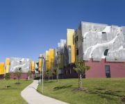
Delve into Shalvey
The district Shalvey of in Blacktown (New South Wales) is a subburb in Australia about 144 mi north-east of Canberra, the country's capital town.
If you need a hotel, we compiled a list of available hotels close to the map centre further down the page.
While being here, you might want to pay a visit to some of the following locations: Parramatta, Sydney, Katoomba, Canberra and . To further explore this place, just scroll down and browse the available info.
Local weather forecast
Todays Local Weather Conditions & Forecast: 25°C / 78 °F
| Morning Temperature | 17°C / 62 °F |
| Evening Temperature | 23°C / 73 °F |
| Night Temperature | 20°C / 68 °F |
| Chance of rainfall | 0% |
| Air Humidity | 56% |
| Air Pressure | 1021 hPa |
| Wind Speed | Moderate breeze with 10 km/h (6 mph) from West |
| Cloud Conditions | Broken clouds, covering 82% of sky |
| General Conditions | Light rain |
Sunday, 17th of November 2024
33°C (92 °F)
20°C (68 °F)
Heavy intensity rain, moderate breeze, overcast clouds.
Monday, 18th of November 2024
31°C (88 °F)
17°C (63 °F)
Light rain, fresh breeze, clear sky.
Tuesday, 19th of November 2024
24°C (75 °F)
18°C (65 °F)
Light rain, moderate breeze, few clouds.
Hotels and Places to Stay
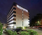
Novotel Sydney Rooty Hill
St. Marys Park View Motel
Colyton Hotel
Blue Cattle Dog Hotel
ALPHA EASTERN CREEK
Western Sydney University Village Penrith
Holiday Inn SYDNEY ST MARYS
Videos from this area
These are videos related to the place based on their proximity to this place.
1976 Mount Druitt High School slideshow part 1
Some of the photos that I took while at Mount Druitt High School in 1976. If you attended the school you may find some interesting. Some of the photos are good quality and others are not.
RC Car Racing Circuit in Mount Druitt
At Whalan Reserve in Mount Druitt in Sydney Australia. Practice day. Google Earth co-ordinates- 33°45'28.08" S 150°47'46.29" E.
BASKETBALL CHALLENGE CUP part 1
The BASKETBALL CHALLENGE CUP played in 2 x 5 minute halves features the Heat vs Razors going head to head at Emerton Leisure Centre in the 1st half. This is the 1st ever BASKETBALL ...
HILTON PARKES REAL ESTATE FOR LEASE LETHBRIDGE PARK 25 TARANAKI AVE
25 Taranaki Ave, Lethbridge Park * Separate lounge & polished floorboards throughout * Dining off kitchen with electric cooking appliances * 4 Spacious bedrooms * Combined bathroom & toilet...
BMW E24 m6 found at ibuywesell.com social classifieds marketplace
The BMW 633CSi E24 evolved into the M635CSi when the M88/1 engine from the M1 was modified to fit into a strengthened 633 chassis. The new engine designation was M88/3. Since the 633 chassis ...
How to Graffiti Remove using Worlds Best Graffiti Remover
Graffiti Removal carried out using Worlds Best Graffiti Remover on Brickwork. Application is by Blast It Clean It Paint It using a pressureless pump sprayer then waiting 3 minutes allowing...
Videos provided by Youtube are under the copyright of their owners.
Attractions and noteworthy things
Distances are based on the centre of the city/town and sightseeing location. This list contains brief abstracts about monuments, holiday activities, national parcs, museums, organisations and more from the area as well as interesting facts about the region itself. Where available, you'll find the corresponding homepage. Otherwise the related wikipedia article.
Division of Chifley
The Division of Chifley is an Australian Electoral Division in New South Wales. The division was created in 1969 and is named for Ben Chifley, who was Prime Minister of Australia 1945–49. It is located in the western suburbs of Sydney. On its original boundaries it was based on Blacktown, but now includes the suburbs of Minchinbury, Mount Druitt and Rooty Hill.
Mount Druitt Hospital
Mount Druitt Hospital is a 200-bed hospital in Sydney suburb of Mount Druitt, New South Wales, Australia. It was opened by Her Majesty Queen Elizabeth II in October 1982, and was designed by Lawrence Nield in 1980. The hospital consists of 120 beds for general medical and surgical use, 62 beds for paediatrics, five intensive care beds (these were removed in 2005), and 13 day-only observation beds. The three commissioned operating theatres have eight beds for recovery.
Mount Druitt railway station
Mount Druitt railway station is on the Western line, Sydney of the CityRail network. It serves a well established residential, educational and commercial area. It has four tracks, paired by direction. This means that all trains to the city leave from the same island platform, so if the train happens to travel on the unexpected track, it is a simple thing to walk over to the other platform.
Oakhurst, New South Wales
Oakhurst is a suburb of Sydney, in the state of New South Wales, Australia 46 kilometres west of the Sydney central business district, in the local government area of the City of Blacktown. It is part of the Greater Western Sydney region.
Mount Druitt
Mount Druitt is a suburb of Sydney, in the state of New South Wales, Australia. Mount Druitt is located 43 kilometres (27 mi) west of the Sydney central business district, in the local government area of the City of Blacktown, and is part of the Greater Western Sydney region. There are numerous encompassing, smaller suburbs nearby including Bidwill, Blackett, Whalan, Tregear, Lethbridge Park and Emerton. The area is one of the poorest suburbs in Sydney and the state of New South Wales.
Bidwill, New South Wales
Bidwill is a suburb of Sydney, in the state of New South Wales, Australia. Bidwill is located 48 kilometres west of the Sydney central business district, in the local government area of the City of Blacktown and is part of the Greater Western Sydney region.
Blackett, New South Wales
Blackett is a suburb of Sydney, in the state of New South Wales, Australia. Blackett is located 48 kilometres west of the Sydney central business district, in the local government area of the City of Blacktown and is part of the Greater Western Sydney region.
Colebee, New South Wales
Colebee is a suburb of Sydney, in the state of New South Wales, Australia. Colebee is located 47 kilometres west of the Sydney central business district, in the local government area of the City of Blacktown and is part of the Western Sydney region.
Dharruk, New South Wales
Dharruk is a suburb of Sydney, in the state of New South Wales, Australia. Dharruk is located 46 kilometres west of the Sydney central business district, in the local government area of the City of Blacktown and is part of the Greater Western Sydney region. Dharruk is chiefly a residential suburb with almost no industry or commercial activity.
Emerton, New South Wales
Emerton is a suburb of Sydney, in the state of New South Wales, Australia. Emerton is located 46 kilometres west of the Sydney central business district, in the local government area of the City of Blacktown and is part of the Greater Western Sydney region. Emerton is primarily a residential suburb with very limited commercial activity centered around the Emerton Leisure Centre. It is quite close to the suburbs of Mount Druitt, New South Wales and St Marys.
Plumpton, New South Wales
Plumpton is a suburb of Sydney, in the state of New South Wales, Australia. Plumpton is located 46 kilometres west of the Sydney central business district, in the local government area of the City of Blacktown and is part of the Greater Western Sydney region.
St Marys, New South Wales
St Marys is a suburb in western Sydney, in the state of New South Wales Australia. It is 45 kilometres west of the Sydney central business district, in the local government area of the City of Penrith. St Marys sits between South Creek which forms the western boundary and Ropes Creek, its eastern boundary.
Oxley Park, New South Wales
Oxley Park is a suburb of Sydney, in the state of New South Wales, Australia on the easternmost side of the City of Penrith Local Government Area. It is 43 kilometres west of the Sydney central business district, in the local government area of the City of Penrith and is part of the Greater Western Sydney region.
Berkshire Park, New South Wales
Berkshire Park is a suburb of Sydney, in the state of New South Wales, Australia. It is in the local government area of City of Penrith and its postcode is 2765. It is a large rural suburb with a population of 1788 in the 2001 census. The suburb has a diverse range of activity, including a pet cemetery, correctional facility, nature reserve, waste management centre and a racehorse education centre.
North St Marys, New South Wales
North St Marys is a suburb in western Sydney, in the state of New South Wales Australia. North St Marys is located 47 kilometres west of the Sydney central business district, in the local government area of the City of Penrith. North St Marys is an extension of the adjoining suburb of St Marys.
St Marys railway station, Sydney
St Marys is a railway station on the Western line, Sydney of the CityRail network. It has four tracks, and the tracks are paired by direction down/down/up/up. This means that all trains to the city leave from the same island platform, so if a train happens to travel on the unexpected track, it is merely a matter of walking to the other side of the island platform. All four platforms can have trains terminated on and sent back to the origin station.
Chifley College Senior Campus
Chifley College Senior Campus is located in Mount Druitt, New South Wales, Australia. It is one of the five schools within Chifley College and is locally known as Chifley Senior.
Dunheved railway station
Dunheved Station is the first station and a junction on the Ropes Creek railway line in Sydney, New South Wales, Australia. It was the only station on the Ropes Creek line named after a suburb.
Cochrane railway station, Sydney
Cochrane Station was the second of three stations on the Ropes Creek railway line in Sydney, New South Wales, Australia.
Ropes Crossing, New South Wales
Ropes Crossing is a suburb of Blacktown, Sydney in the state of New South Wales, Australia. Ropes Crossing is located 49 kilometres west of the Sydney central business district, in the local government area of the City of Blacktown and is part of the Greater Western Sydney region.
Mount Druitt Aerodrome
Mount Druitt Aerodrome was a Royal Australian Air Force (RAAF) landing ground during World War II at Mount Druitt, New South Wales, Australia. Land was resumed in March 1942, for the construction of an aerodrome, two aircraft hangars and workshops on the site. The runway was 5000ft (1524m) long x 159ft (48.46m) wide.
St Marys Senior High School
St Marys Senior High School is an academically comprehensive senior high school. It is a post-compulsory, public, co-educational, senior high school, located in St Marys, a Western Suburb of Sydney, New South Wales, Australia. Established in 1989, the school is the first NSW Government senior high school and currently caters for approximately 850-900 students from Years 11 and 12.
Baitul Huda, Sydney
The Baitul Huda (House of Guidance) is a Mosque in Sydney run by the Ahmadiyya Muslim Community (AMA) in Australia. The land for the mosque at Marsden Park (Sydney) was purchased in 1983. Mirza Tahir Ahmad, Khalifatul Masih IV. laid the foundation stone on the 30th of September on his first visit to Australia 1983. The first missionary, Mr. Shakil Ahmad Munir and his wife, Mrs. Naima Munir came to Australia on the 5th of July 1985.
2WOW
Wow FM (100.7 FM, callsign "2WOW") is a community radio station based in St Marys in Sydney. The station broadcasts to part of Western Sydney, mainly centered around the City of Penrith. Wow FM is a volunteer run organisation and is funded through listener support, grants and limited commercial sponsorship.
Loyola Senior High School, Mount Druitt
Loyola Senior High School is a Roman Catholic co-educational day school for students years 11-12 located in Mount Druitt, New South Wales, Australia. An Ignatian school in the tradition of St Ignatius of Loyola, it is situated in Sydney's Western Suburbs in a seven hectare lightly wooded, landscaped site which received the Sulman Award from the Royal Institute of Architects for its design.


