Touring Macarthur
The district Macarthur of in Australian Capital Territory with it's 1,582 residents Macarthur is a subburb located in Australia a little south of Canberra, the country's capital place.
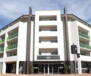
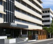
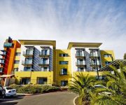
Need some hints on where to stay? We compiled a list of available hotels close to the map centre further down the page.
Being here already, you might want to pay a visit to some of the following locations: Canberra, Katoomba, Parramatta, Sydney and Hay. To further explore this place, just scroll down and browse the available info.
Local weather forecast
Todays Local Weather Conditions & Forecast: 20°C / 69 °F
| Morning Temperature | 11°C / 53 °F |
| Evening Temperature | 20°C / 68 °F |
| Night Temperature | 15°C / 59 °F |
| Chance of rainfall | 0% |
| Air Humidity | 47% |
| Air Pressure | 1020 hPa |
| Wind Speed | Moderate breeze with 11 km/h (7 mph) from South-West |
| Cloud Conditions | Overcast clouds, covering 95% of sky |
| General Conditions | Overcast clouds |
Saturday, 16th of November 2024
27°C (81 °F)
16°C (60 °F)
Light rain, moderate breeze, clear sky.
Sunday, 17th of November 2024
30°C (86 °F)
17°C (63 °F)
Heavy intensity rain, strong breeze, overcast clouds.
Monday, 18th of November 2024
21°C (70 °F)
10°C (49 °F)
Light rain, moderate breeze, clear sky.
Hotels and Places to Stay
Georgie's Boutique B&B
Abode Tuggeranong
ibis Styles Canberra
BEST WESTERN GARDEN CITY
Abode Woden
Quality Hotel Woden
Sundown Motel Resort
Canberra Short Term & Holiday Accommodation
Statesman Hotel
ALPHA HOTEL CANBERRA
Videos from this area
These are videos related to the place based on their proximity to this place.
SUMMERNATS 28 CITY CRUISE CARS, January 2015 Canberra
Approximately two hundred of Summernats' finest rides find their stride as they leave Exhibition Park to cruise towards the bumper crowds lining Northbourne Avenue in Canberra! See you at ...
Tuggeranong Pines - Centre Doubles
Old footage of jumping the large set of doubles in the centre of tuggeranong pines.
YWCA Computer Clubhouse: our story
YWCA Canberra's Computer Clubhouse is an innovative, creative, out-of-school learning space where young people from underserved communities can work with adult mentors to develop new skills,...
Mt Rob Roy Romps
The Mt Rob Roy "Romps" mountain runs - Mt Rob Roy Classic 22.8k, Appleby's Fruity 17k, Short's Flattish 10k.
The Bakery Bunch
Just like any other Saturday morning (6am summer, 7am winter). Starting from Bike Shed in Phillip....and mixing it up with Michael Rogers et al - beware the late charge from Gerard Tiffen.
Woden Tyre and Exhaust
Woden Tyre and Exhaust in Phillip, Canberra. https://plus.google.com/113100331983941858491/about?gl=au&hl=en.
Videos provided by Youtube are under the copyright of their owners.
Attractions and noteworthy things
Distances are based on the centre of the city/town and sightseeing location. This list contains brief abstracts about monuments, holiday activities, national parcs, museums, organisations and more from the area as well as interesting facts about the region itself. Where available, you'll find the corresponding homepage. Otherwise the related wikipedia article.
Tuggeranong
Tuggeranong is the southernmost town centre of Canberra, the capital city of Australia. It comprises 19 suburbs with a total of 31,819 dwellings, housing 87,119 people of the 324,034 people in the Australian Capital Territory. The district occupies 117 square kilometres to the east of the Murrumbidgee River. From the earliest colonial times, the plain extending south into the centre of the present-day territory was referred to as Tuggeranong.
Calwell, Australian Capital Territory
Calwell is a medium sized suburb of Canberra, Australia in the district of Tuggeranong. Tuggeranong Hill is on its southern border and the Tuggeranong Homestead is to the north. Calwell is located close to the Monaro Highway which provides a direct route to Canberra City and to Cooma.
Gowrie, Australian Capital Territory
Gowrie is a suburb of Canberra, Australia, located in the northern end of the Tuggeranong Valley. Tuggeranong suburbs are the southernmost of Australia's capital city. Gowrie is named after Brigadier-General Alexander Gore Arkwright Hore-Ruthven, 1st Earl of Gowrie (1872–1955), Governor-General of Australia from 1936-1944. Gowrie's streets are all named after members of the Australian Defence Force who won decorations, including the Victoria Cross.
St Mary MacKillop College, Canberra
St Mary MacKillop College, formerly known as MacKillop Catholic College, is a Catholic high school in the Australian capital of Canberra, with two campuses in the Tuggeranong Valley. The school is the result of an amalgamation of Padua High School and St. Peter's College in 1998. It is the largest school in Canberra. Mackillop College describes itself as a "dynamic and welcoming community where excellence in education is valued". Mackillop College accepts students from year 7 to 12.
Caroline Chisholm School – Senior Campus
The newly amalgamated senior campus of Caroline Chisholm School (previously Caroline Chisholm High School), is an Australian public high school in the Chisholm suburb of Canberra in the Australian Capital Territory (ACT) catering to years 6 to 10. It is one of the many new 'super schools' operated by the ACT Department of Education and Training.
Farrer, Australian Capital Territory
Farrer is a suburb in the Canberra, Australia district of Woden. The postcode is 2607.
Isaacs, Australian Capital Territory
Isaacs is a suburb in the district of Woden in Canberra, Australia. The postcode is 2607. The suburb was gazetted as a Division Name on 12 May 1966 but residential housing was not built until the late 1980s. Isaacs is next to the suburbs of O'Malley, Mawson and Farrer. It is bounded by Yamba Drive and Ngunawal Drive. Located in the suburb is the Canberra Nature Park of Isaacs Ridge and the Long Gully pine plantation.
Chisholm, Australian Capital Territory
Chisholm is a suburb in the Canberra, Australia district of Tuggeranong, named after Caroline Chisholm. It was gazetted on 5 August 1975, and streets are named after notable women. It is nearby suburbs of Gilmore, Fadden, and Richardson. It is bounded by Isabella Drive, and the Monaro Highway. Chisholm and Gilmore are separated by Simpsons Hill, which provides some wilderness with walking tracks over it, popular for walking dogs.
Fadden, Australian Capital Territory
Fadden is a suburb in the Canberra, Australia district of Tuggeranong. The postcode is 2904. The suburb is named after Sir Arthur Fadden, Prime Minister of Australia briefly in 1941. It was gazetted on 5 August 1975. Its streets are named after Queensland politicians. It is surrounded by Macarthur, Gowrie and Wanniassa. It is bounded by Erindale Drive, the Wanniassa Hills Nature Reserve, Fadden Pine Plantation and Sternberg Crescent.
Gilmore, Australian Capital Territory
Gilmore is a suburb in the Canberra, Australia district of Tuggeranong. The postcode is 2905. The suburb is named after the poet and journalist, Dame Mary Gilmore. It was gazetted on 5 August 1975. Streets are named after journalists, particularly female journalists. It is next to the suburbs of Macarthur and Chisholm and is bounded by the Monaro Highway, Isabella Drive and Hambidge Crescent.
Isabella Plains, Australian Capital Territory
Isabella Plains is a suburb in the Canberra, Australia district of Tuggeranong. The postcode is 2905. The suburb is indirectly named after Isabella Maria Brisbane (1821–1849), who was the daughter of Thomas Brisbane the colonial Governor of New South Wales when the area was first explored by white settlers in 1823. Joseph Wild was employed by Brigade Major John Ovens and Captain Mark Currie to guide them to the Murrumbidgee River.
Macarthur, Australian Capital Territory
Macarthur (postcode 2904) is a suburb in the Canberra district of Tuggeranong. The suburb is named after John Macarthur, one of the founders of Australia's Merino wool industry. It was gazetted on 22 March 1982 and first settled in 1983. The wool industry is the theme for street names. The suburb has an area of 1.27 km². It is next to the suburbs of Fadden and Gilmore, and is located north of Isabella Drive.
Monash, Australian Capital Territory
Monash (postcode 2904) is a suburb in the district of Tuggeranong, Canberra, Australia. The suburb is named after General Sir John Monash, (1865 to 1931), who commanded the Australian Army in France in the First World War. It was gazetted on 1 August 1975 and first settled in 1978. The suburb has an area of 3.41 km². Streets are named after engineers and the suburb consists primarily of detached houses on suburban blocks.
Richardson, Australian Capital Territory
Richardson is a suburb in the Canberra, Australia, district of Tuggeranong. The postcode is 2905. The suburb is named after the author Henry Handel Richardson, nom de plume of Ethel Florence Lindesay Richardson (1870–1946). It was gazetted on 5 May 1975. Streets are named after writers, especially female writers. It is next to the suburbs of Calwell, Isabella Plains, Gowrie and Chisholm. It is bounded by Johnson Drive, Ashley Drive and Isabella Drive.
Theodore, Australian Capital Territory
Theodore is also the name of a town in Queensland Theodore is a suburb in the Canberra, Australia district of Tuggeranong. The postcode is 2905. The suburb is named after Edward Glanville Theodore (1884–1950), a Queensland premier and deputy Prime Minister. It was gazetted on 5 August 1975. Streets are named after people involved with the civilian war effort during the world wars.
Wanniassa, Australian Capital Territory
Wanniassa (postcode 2903) is a suburb in the Canberra, Australia district of Tuggeranong. It is located towards the north of the district. The suburb takes its name from a pastoral property granted to Thomas McQuoid in 1835, which he named after Wanajassa in West Java, Indonesia, where McQuoid had previously owned property. Streets are named after Victorian state politicians and the suburb was gazetted on 21 May 1974.
Erindale Centre
The Erindale Centre is a designated group centre located in the Canberra suburb of Wanniassa. It stands on the former site of the Erindale Homestead for which it is named, and serves the suburbs of Wanniassa, Monash, Gowrie, Fadden and Oxley. Erindale was developed in 1985, two years before the Tuggeranong Hyperdome and was intended as a “district retail centre”.
Tuggeranong Homestead
Tuggeranong Homestead is located in the Australian Capital Territory in the area now covered by the suburb of Richardson. The first authorised landowner of the Tuggeranong area following white settlement was Peter Murdoch, aide-de-camp of Thomas Brisbane, who was awarded a grant of 2,000 acres (8 km²) in 1827. Following Murdoch's appointment to a position in Tasmania in 1829, the area became part of a grant to John McLaren who arrived from Glasgow in 1828.
1VFM
Valley FM 89.5 is a community radio station which broadcasts on 89.5MHz from its studios at the Erindale Centre, in the southern Canberra suburb of Wanniassa. All of the station's staff and presenters are volunteers, and the station operates as a completely non-profit entity. Valley FM 89.5 has been on air since June 1999 and holds a Permanent Community Broadcasting Licence (PCBL). The station is also a full member of the Community Broadcasting Association of Australia (CBAA).
Viking Park
Viking Park is an 8,000 capacity stadium (2,000 seated) in Canberra, Australia. It has a rectangular playing surface which is used to host rugby union matches. It is home to the Tuggeranong Vikings and all matches in the ACT rugby finals are played here. The Canberra Vikings also played there in 2004 & 2005 when they were in the Tooheys New Cup. The Brumbies in Super Rugby sometimes use it for training and will play their home games in the Australian Provincial Championship at the venue.
Tuggeranong Parish
Tuggeranong Parish, Murray County is a parish of Murray County, New South Wales, a cadastral unit for use on land titles. It is now about a third of the size it was in the nineteenth century, after most of the land in the parish was transferred to the Australian Capital Territory in 1911.
Alliance Church Calwell
The Alliance Church Calwell is a Christian and Missionary Alliance church based in Tuggeranong, the southernmost town center of Canberra. This church has, in the past, been referred to as the Tuggeranong Alliance Church.
Trinity Christian School, Canberra
Trinity Christian School, founded in 1980, is a private Christian K-12, co-educational school located in Wanniassa in the Tuggeranong Valley of Canberra ACT Australia.
Mount Wanniassa
Mount Wanniassa is a mountain peak located in Canberra, Australia, nestled between the suburbs of Wanniassa, Farrer, Isaacs and Fadden. The mountain is part of the Wanniassa Hills Nature Reserve, a Canberra Nature Park and adjacent to the Farrer Ridge Nature Reserve. Mount Wanniassa stands at 809 metres above sea level, and provides excellent views of the Woden and Tuggeranong areas of Canberra. The mountain can be climbed via the established walking trails on the east and west slopes.
Tuggeranong Creek
Tuggeranong Creek, a partly perennial stream of the Murrumbidgee catchment within the Murray-Darling basin, is located in the Tuggeranong district of Canberra, within the Australian Capital Territory, Australia. Tuggeranong is derived from the Aboriginal word, meaning "cold plain". The traditional custodians of the land surrounding Tuggeranong Creek are the Aboriginal people of the Ngunnawal tribe.


