Safety Score: 3,6 of 5.0 based on data from 9 authorites. Meaning please reconsider your need to travel to Albania.
Travel warnings are updated daily. Source: Travel Warning Albania. Last Update: 2024-08-13 08:21:03
Delve into Grizhë Numër Dy
The district Grizhë Numër Dy of Grizhë in Qarku i Shkodrës is a district located in Albania about 67 mi north of Tirana, the country's capital town.
In need of a room? We compiled a list of available hotels close to the map centre further down the page.
Since you are here already, you might want to pay a visit to some of the following locations: Koplik, Kastrat, Hot, Grude-Fushe and Gruemire. To further explore this place, just scroll down and browse the available info.
Local weather forecast
Todays Local Weather Conditions & Forecast: 13°C / 55 °F
| Morning Temperature | 9°C / 48 °F |
| Evening Temperature | 10°C / 50 °F |
| Night Temperature | 9°C / 48 °F |
| Chance of rainfall | 0% |
| Air Humidity | 60% |
| Air Pressure | 1018 hPa |
| Wind Speed | Light breeze with 4 km/h (3 mph) from South-West |
| Cloud Conditions | Overcast clouds, covering 97% of sky |
| General Conditions | Overcast clouds |
Thursday, 5th of December 2024
10°C (49 °F)
8°C (46 °F)
Moderate rain, light breeze, overcast clouds.
Friday, 6th of December 2024
10°C (50 °F)
8°C (47 °F)
Light rain, light breeze, overcast clouds.
Saturday, 7th of December 2024
11°C (51 °F)
11°C (52 °F)
Light rain, light breeze, overcast clouds.
Hotels and Places to Stay
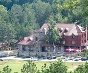
NATYRAL RAZMA RESORT
Videos from this area
These are videos related to the place based on their proximity to this place.
Tabakzerkleinerung in Albanien
So wird Tabak in Albanien zerkleinert.Natürlich gibts auch Industrielle Maschinen:
Tour-2010-09-25.mp4
Fahrvideoaufnahmen und Fotos von der Teilstrecke "Shkoder nach Valbona" (Albanien). Für die Strecke habe ich mit dem Motorrad knapp drei Stunden benötigt.
Videos provided by Youtube are under the copyright of their owners.
Attractions and noteworthy things
Distances are based on the centre of the city/town and sightseeing location. This list contains brief abstracts about monuments, holiday activities, national parcs, museums, organisations and more from the area as well as interesting facts about the region itself. Where available, you'll find the corresponding homepage. Otherwise the related wikipedia article.
Malësi e Madhe District
The Malësi e Madhe District (Albanian: Rrethi i Malësisë së Madhe) is one of the thirty-six districts of Albania, part of Shkodër County. It has a population of 36,091 (2010 estimate), and an area of 555 km². It is in the north of the country, and its capital is Koplik.
Tuzi
Tuzi is a settlement in the Podgorica municipality, Montenegro, located along a main road between the city of Podgorica and the Albanian border crossing, just a few kilometers north of Lake of Shkodra. The exact location of Tuzi is {{#invoke:Coordinates|coord}}{{#coordinates:42|21|56|N|19|19|53|E| | |name= }}. Tuzi is urban municipality, a subdivision of Podgorica municipality.
Lake Skadar
Lake Skadar — also called Lake Scutari and Lake Skadar — lies on the border of Montenegro with Albania, the largest lake in the Balkan Peninsula. It is named after the city of Shkodra in northern Albania.
Maja e Popljuces
Maja e Popljuces is a mountain in Albania in the Prokletije. It is 2,569m high and it itself is surrounded by many peaks above 2,500m. It is located just south from Maja Jezercë.
Maja e Veleçikut
Maja e Veleçikut is a peak in Albania, part of the Prokletije. It is 1,725m high and is found in the western part of the range, near Lake Scutari and the border with Montenegro.
Nikmaraš
Nikmaraš is a settlement in the rural community of Zatrijebač, in Podgorica, Montenegro, near the border with Albania. It is part of the wider Kuči clan region, specifically in the Zatrijebač region (alb. Triesh, part of wider Malësia from Albanian point of view). According to the 2003 census, the village has 13 inhabitants, all ethnic Albanians. The village owes its name to the Zatrijebač chieftain Nik Maraš Kalčević (Nik Marashi).
Mes Bridge
Mes Bridge (Albanian: Ura e Mesit "bridge in the middle") is a bridge in the village of Mes, about five kilometres (straight line) northeast of Shkodër, in northwestern Albania. It was built in the 18th century, around 1780, by Kara Mahmud Bushati, the local Ottoman pasha, and it spans the Kir River. It is 108 m long, and represent one of the longest Ottoman bridges in the region. It was built as part of the road that goes up the Kir Valley, eventually to Pristina.
Bajzë Rail Station
The Bajzë Rail Station (Albanian: Stacioni Hekurudhor i Bajzë) is a railway station located in Bajzë, Albania. It serves Albanian Railways as a freight line between Bajzë and Shkodër with an extension to the Montenegrin capital, Podgorica operated by Railways of Montenegro. Two freight trains pass daily through the station, hauling over 10,000 tonnes of commodities monthly. Long term plans exist to establish and operate international passenger trains between Albania and Montenegro via Bajzë.
Kratul
Kratul was an Illyrian settlement and fortification located in the territories of the Illyrian tribe of Labeates. The archaeological material indicates that life at the settlement was active from the early Iron Age (beginning of 1st millennium BC) until the 1st century AD.
Baleč
Baleč or Baleš was a medieval fortified town near Shkodër in contemporary Albania. It was built on the hill whose name was Baleš (later known as Balezo or Maja e Balecit). The settlement was built on the ruins of former Roman castle. During the Byzantine rule over the area, it was part of Dyrrhachium theme and later it was a seat of župa of the Kingdom of Duklja and later of the Lordship of Zeta.


